 |
 |
|
|
 |
 |
 |
 |
|
|
MPSuperShape is a shape manipulation tool for Microsoft MapPoint. MPSuperShape can be used to combine multiple shapes into one large shape, find the intersections (overlaps) between shapes, find boundary shapes around groups of pushpins, import/export shape files, and to create web pages. Import shape options include ESRI Shape (SHP) files, MapInfo MIF files, Keyhole (KML), and GML. MPSuperShape can also export to ESRI Shape (SHP) files; MapInfo MIF files; GML; KML; and webpages that use Google Maps or Microsoft Bing Maps (Virtual Earth). Shapefile SHP and MapInfo MIF import/export options support different projections and coordinate systems.
Possible applications include: Combining drive-time areas to find the total area covered by existing depots; Finding territory overlaps; Finding areas which meet multiple characteristics; Finding territory boundaries around groups of customer pushpins; Transferring shapes to/from other GIS systems; Create webpages from MapPoint shapes and pushpins. MPSuperShape provides the following benefits: Combine multiple shapes; Find the intersection (overlap) between shapes; Find boundary shapes around a group of pushpins; Import shapes from external (non-MapPoint) files; Export shapes to external (non-MapPoint) files; Create webpages that use Virtual Earth or Google Maps to display MapPoint pushpins and/or shapes; Copy shapes between different MapPoint maps - reuse the same shapes on multiple maps. The import and export options support GML and KML. GML is an XML-based open GIS format that is managed by the Open Geospatial Consortium. KML ('Keyhole Markup') is the XML language for Google Earth, but it is also supported by Google Maps and Microsoft Bing Maps. Requirements: MapPoint 2006 (or later), .NET Framework 2.0 (or later), and Windows XP, Vista, or Windows 7 required.
|
|
Editor review: Reviewer, 2008-11-25 08:20:00
MPSuperShape is a shape manipulation tool for Microsoft MapPoint. MPSuperShape can combine shapes, find overlaps, find boundaries, and import/export various files.
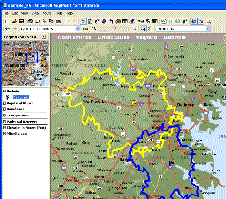
Pros: MPSuperShape is a Geographic Information system(GIS) tool. It can manipulate shapes created by analysis. You can enhance these analyses by combining shapes differently. This is an application built on MS MapPoint. You can import shapes from ESRI Shape (SHP) files, MapInfo MIF files, Keyhole (KML), and GML. Export to KML and GML are possible as also to web pages that uses Google Maps or Microsoft Virtual Earth (`Live Local`). The kind of analyses that can be done are diverse. For example, combining drive-time areas to find the total area covered by existing depots or finding areas which meet multiple characteristics or finding territory overlaps are some examples. Other examples include finding territory boundaries around groups of customer pushpins, transferring shapes to/from other GIS systems etc. You are able to create maps on web pages from MapPoint shapes and pushpins provided by users. MapPoint 2006 (or later), .NET Framework 2.0 (or later), and Windows XP or Vista required.
Cons: This is not for ordinary users. You have to have understanding of GIS to be able to use this effectively.
Overall: This has a nice set of features and a very useful tool for mapping applications that are appearing increasingly on websites. It is easy to use and rates a overall 4 star easily.
|
 |
 |
Visit homepage of MPSuperShape
Download MPSuperShape 2.0
Popular search terms related to MPSuperShape:
virtual drive, google, google.com, shape, maps, xml, area, virtual, virtual cd, net
|

create virtual drive virtual drive windows how to open rm files copy many files combine ts files combine files virtual cd drive best virtual drive vista like copy files

Programs related to MPSuperShape
|