Free download RTOPO

RTOPO

3.2
Simple, powerful and inexpensive CAD software for surveying. You can do triangulation, isolines
Free Download
User rating
4.3/10
7 votes
License
Shareware
OS
Windows
Developer
Version
3.2
File size
2.5 MB
Language
English
Release date
6 October 2015

Editor's review

This software helps in digital terrain modeling by triangulated irregular network(TIN) and editing of the same to create the model.

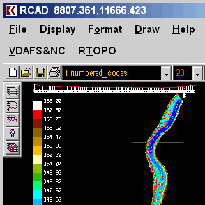
A triangulated irregular network or TIN is a representation of data, or data structure, used in GIS. These networks are used to represent digital terrain models that show the topography of the ground or the sea bottom. It is a vector based representation. Rather than using a raster DTM, the TIN helps reduces the amount of data required for creating the elevation models. This program is able to use the TIN data in 3DPOLY, SPLINE or BLOCK entities. The program also helps in editing (modify, delete or add) of 3D points, and for triangulation. It also helps create isolines, color-filled contour maps, cross sections, longitudinal profile, 2D entities (Line or PLine) projection over a DTM, Conversion of TIN data also is possible you a regular grid of points.

You can convert existing isolines into points and then convert to TIN. The tool contains a library of BLOCKS as also code. Both of these are modifiable. Other features are available that help building the elevation model. The Program has RCAD graphic core and is distributed along with the program. The graphic core gives you the capability to manipulate the 3D model you created. The operations include OpenGL real-time orbit, pan, zoom, shading, lighting and motion path animation. If you are into creating DEMs, you ought to give this tool a try. The price is cheap enough, the interface is simple enough and it should take very little time to start operating, if you know the field of application already.

Publisher's description

Simple, powerful and inexpensive CAD software for surveying. You can do triangulation, isolines, color-filled contour maps, sections, intersections, volume and much more. You can process hundreds of thousands of points or triangles, even on less powerful PCs.
Through its own CAD system (called RCAD), specialized for 3D and for a large number of entities, you can:
-load and draw a file of points having the format: Number X Y Z Code; the drawing is made by POINT,3DPOLY,SPLINE or BLOCK entities, according to a modifiable library of codes
-edit interactively the points; you can modify the coordinates, the code and the position (in 3DPOLY or SPLINE)
-triangulate the points on a convex hull or between an external contour and possibly more interior contours
-do isolines (contour lines) and color-filled contour map
-do cross sections and longitudinal profile
-do the projection of several PLine entities over a triangulation
-do the conversion of a triangulation to a regular grid of points
-do the conversion of the existing isolines resulting from maps in points and then in a triangulation
-represent the geological_stratification resulting from drilling
-calculate 3D area, center of gravity and the volume between 2 triangulations or between a triangulation and a plan
-intersect and divide two triangulations (or two sets of 3dmesh and 3dface entities) or a triangulation by a horizontal plan
-interpolate a set of 3DFACE entities, using quartic triangular patches (G1 continuity)
-transform a drawing containing entities as PLine, Line, Block and Text, in points having codes and then in a triangulation,
-represent 4D points cloud.
RCAD CAD system, distributed together with RTOPO, provides OpenGL real-time orbit, pan,zoom, shading, lighting and motion path animation. RCAD is similar with other popular CAD systems and can load and save DXF files. It has entries in the command text area, graphics area, menus and toolbars and can run scripts.
RTOPO
RTOPO
Version 3.2
Free Download

User comments

Rate this program